 NERC Data Catalogue Service
Northumbria University
Type of resources
Topics
Keywords
Contact for the resource
Provided by
Years
Formats
Representation types
Update frequencies
Resolution
-
These data are digital elevation models (DEMs) of difference (DoD). They are a geospatial dataset created in raster (.tif) format and quantify vertical (z) topographic change between two dates. The data were created to support analysis of landscape change following the 7th February 2021 avalanche-debris flow in Chamoli District, Uttarakhand, India. The data also supported numerical modelling using CAESAR-Lisflood (see related data collection). They are most commonly imported into GIS software, where they can be analysed or support other forms of geospatial analysis. Full details about this dataset can be found at https://doi.org/10.5285/f5394eaa-5ccb-4cf7-9ee4-c057c35b8517
-
These data are digital elevation models which describe landscape topography. The data were created to support analysis of landscape change following the 7th February 2021 avalanche-debris flow in Chamoli District, Uttarakhand, India. The data were used as standalone datasets to support this analysis, but also supported numerical modelling using CAESAR-Lisflood (see data collection). The DEMs were created from CNES/Airbus Pléiades-HR stereo satellite imagery captured in along-track mode. They are a geospatial dataset created in raster (.tif) format. They are most commonly imported into GIS software, where they can be analysed or support other forms of geospatial analysis. Full details about this dataset can be found at https://doi.org/10.5285/5a1eaef4-9211-4227-a017-d20b08be5784
-
These data are input files for CAESAR-Lisflood (CL), a numerical hydrodynamic-landscape evolution model. These files were created to support coupled hydrodynamic-landscape evolution modelling to evaluate the geomorphological response of river channels affected by the 7th February 2021 ice-rock avalanche and debris flow in Chamoli District, Uttarakhand, India. They include 10 m digital elevation models (DEMs) of bed rock and land surface topography in a gridded (raster) format. They also include reanalysis-derived river discharge data generated by the GEOGloWS project at the following locations: Rontigad, Rishiganga, Dhauliganga, and Alaknanda. The configuration settings and parameters for CL modelling are also included. Full details about this dataset can be found at https://doi.org/10.5285/4cdd86b3-bf58-457d-b8cf-b57aed2d56d0
-
These data are GIS shapefiles which contain geospatial information describing the location and condition of bridges, buildings and roads in Chamoli District, Uttarakhand, India, following the 7th February 2021 avalanche and debris flow hazard cascade (the so-called ‘Chamoli event’). The dataset also contains a GIS shapefile which contains polygon outlines supporting geomorphological analysis of change in river valleys between the avalanche source and the town of Joshimath. The latter is designed to be used in conjunction with the other data resources contained in this data collection. Full details about this dataset can be found at https://doi.org/10.5285/a763e254-c249-4934-b0fb-c3b808b37db6
-

A dataset of airborne particulate matter (PM10 and PM2.5) readings (every 3 minutes) collected by participating households in Northeast England in their kitchens and living rooms over the course of one week, along with data from a linked questionnaire survey and metal(oid)s data from a corresponding household vacuum dust sample collected by the study participant. Matched air monitoring and dust sample collection took place between June 2020 and August 2021. We increasingly spend time indoors and household air pollution results in an estimated 4.25 million premature deaths globally each year. The majority of these deaths are associated with fine particulate matter (PM), or dust. Exposure to PM can initiate or enhance disease in humans, yet the nature of the hazard that house dust presents remains poorly characterized. The data was collected to provide concentrations of PM2.5 and PM10 in a range of Northeast England households and concentrations of metal(oid)s in their house dust. It will be of interest to those interested in human exposure to potentially toxic elements and environmental health. We used factory calibrated Aeroqual 500 units for PM monitoring. Metal(oid)s data were generated using a SPECTROSCOUT X-Ray fluorescence spectrometer on the <250um sieved fraction of household vacuum dust. This dataset was part of NERC Grant NE/T004401/1.
-

The <250um fraction of 28 household vacuum dust samples were extracted using high throughput isolation of microbial genomic DNA (21 samples from a national campaign within the UK and 7 samples from Greece, providing samples from two contrasting bioclimatic zones). Both positive and negative reagent controls were included to ensure sterility throughout the processing and sequencing steps, and a randomly selected sample was run in triplicate (DSUK179). These data (raw fastq files: Target_gene 16S and Target_subfragment V4) are available from the European Nucleotide Archive via the study accession PRJEB46920 with individual sample accession numbers ERX6130460 to ERX6130493; https://www.ebi.ac.uk/ena/browser/view/PRJEB46920). A wide range of anthropogenic factors are likely to affect the indoor microbiome and to capture some of this heterogeneity participants were asked to complete a questionnaire. In addition, trace element data were generated using an X-Ray fluorescence spectrometry on the <250um sieved fraction of the household vacuum dust. Sample location data are provided at town/city, Country level. Indoor dust serves as a reservoir for environmental exposure to microbial communities, many of which are benign, some are beneficial, whilst some exhibit pathogenicity. Whilst non-occupational exposure to a range of trace elements and organic contaminants in house dust are a known risk factor for a range of diseases and poor health outcomes, we know far less about the microbial communities associated with our indoor home environments, and their interaction/impacts on human health. Our knowledge of indoor residential bacterial biodiversity, biogeography and their associated drivers are still poorly understood. The data were collected to improve our understanding of the home microbiome.
-

A dataset of trace metal concentrations (As, Cu, Cr, Mn, Ni, Pb and Zn) in indoor dust from homes from 11 countries, along with a suite of potentially contributory residential characteristics. A household vacuum dust sample, collected by the study participant using their regular vacuum cleaner, was submitted to the laboratory for analysis by X-Ray fluorescence spectrometry (XRF) on the <250um sieved fraction, along with the completion of an online questionnaire survey. Dust sample collection took place between 2018 – 2021. The Home Biome project is affiliated to the DustSafe community science programme (see mapmyenvironment.com). Sample location data are provided at town/city and Country level. Health risk from exposure to potentially contaminant-laden dust has been widely reported. Given the amount of time people spend indoors, residential environments are an important but understudied environment with respect to human exposure to contaminants. Indeed, the nature of the hazard that house dust presents remains poorly characterized. These data will be of interest to those interested in human exposure to potentially toxic elements and environmental health, as well as to the participants, who received a bespoke report on their sample data and information on key sources and ways to reduce exposure to trace elements in indoor dust.
-
The <250um fraction of 19 household vacuum dust samples (collected by citizen participants during 2019-2021) were extracted using high throughput isolation of microbial genomic DNA and sequenced using Illumina NextSeq (12 samples from a national campaign within the UK, 7 samples from Greece and a negative reagent control included to ensure sterility throughout the processing and sequencing steps). These data are available (following period of embargo) from the European Nucleotide Archive via the individual sample accession numbers ERS9609044 to ERS9609063, submitted under the study ID PRJEB49546. Sample location data are provided at town/city, country level. Given the amount of time people spend indoors, residential environments are perhaps the most important, but understudied environments with respect to human exposure to microbes and other contaminants. Across our urban environments, anthropogenic activities (both current and legacy) provide for multiple sources and pathways for the generation and distribution of microbes, inorganic and organic contaminants within the home environment, yet we know relatively little about the potential for dissemination of antibiotic resistance in microbial communities within indoor dust.
-
Data include four charcoal concentration datasets derived from radiocarbon-dated lake sediments in the Brazilian Pantanal, from which regional fire histories can be inferred over the last few millennia. Each dataset provides raw counts of charcoal fragments > 125 um calculated per cubic centimetre of sediment. Samples measuring 0.5 to 1.5 cc were analysed at each 1-cm depth. Contained within each data sheet are radiocarbon dates for several horizons in the lake sediment for the derivation of age-depth models for a chronological framework for each record. Full details about this dataset can be found at https://doi.org/10.5285/56915f15-46b5-4693-8737-28c985f27f80
-
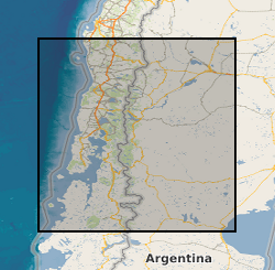
Stratigraphic and ecological data from tidal marsh sites in south-central Chile. Includes stratigraphy, diatom assemblages and radiocarbon dates from fossil cores and diatom assemblages from modern tidal marsh samples. Data were collected to provide evidence for multiple great earthquakes in south-central Chile, and enable the reconstruction of vertical land-level changes associated with these earthquakes. Data are from tidal marsh sites within the 1960 earthquake rupture area along the Chilean subduction zone (37.5 - 46 degrees South).